Coastal Protection Project

Ganapatipule, Ratnagiri, Maharashtra |  Government of Maharashtra

Overview

The project site is located near Ganapatipule near Ratnagiri on the coastal stretch of the Arabian Sea coast of Maharashtra, India which is a well-known tourism destination in Maharashtra and attracts large numbers of visitors for beach recreation, pilgrimage, and marine tourism activities including scuba diving and coastal sightseeing. The Google coordinates of the project location are 17.14° N latitude and 73.27° E longitude. The shoreline in this region is characterized by a pocket beach morphology controlled by lateritic headlands and hillock-type formations projecting into the sea. One such prominent geomorphic feature near the project site resembles a “dolphin nose” type promontory, which significantly influences local wave transformation and sediment movement along the beach.

The coastal environment in this region also supports sensitive ecological systems including coastal vegetation and mangrove habitats in nearby creeks and estuaries. Protection of the shoreline is therefore important not only to safeguard the hinterland and infrastructure but also to preserve the natural beach environment and tourism.

Challenge

Wave Climate Variability

Ratnagiri coastline is exposed to the Arabian Sea wave climate, which is strongly seasonal and dominated by the southwest monsoon. During the fair-weather period (October to May), wave conditions are relatively moderate and beaches generally undergo natural recovery. During the southwest monsoon season (June to September), wave heights increase significantly and the coastline experiences high-energy wave conditions, which can induce erosion of the beach and backshore areas. Oceanographic studies along the coastal zones near Ganpatipule indicate that non-monsoon breaker wave heights generally range between 0.2 and 1.1 m, while during the southwest monsoon the breaker heights increase to approximately 0.5 to 2.3 m. This seasonal variation in wave climate results in foreshore widening & beach erosion

Ecological Preservation

Ratnagiri coastline is home to diverse ecological systems & vegetation, which also supports the communities in the nearby regions. Due to high energy waves during the monsoon period, this ecological & natural systems get disturbed & may cause decay over prolonged periods. Sediment transportation Complexity: Seasonal variation in wave climate impacts sediment transportation. During monsoon period, when high energy waves hit the coast line, sediment redistribution occurs, impacting the shore line & ecological systems.

Solution

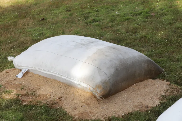
The coastal protection solution adopted at the site consists of a geobag dyke system constructed parallel to the shoreline, combined with geotextile tube groynes placed perpendicular to the coast. The geobag dyke is constructed using Engineered Geobags made of High Tenacity Polypropylene fabric made to a size of 2.0m x 1.5m x 0.4m designed to hold a weight of 2MT to resist the destabilizing wave forces and brace up the dyke with stable units of Geobags forming a trapezoidal geometry. The Geobag units fabricated using engineered fabrics which are designed to resist high hydrodynamic stresses and offer endurance for design life by resisting abrasion & UV degradation.

Project Outcome & Performance

The integrated use of geobag dyke with engineered Geobag units designed for its stability and endurance provides an effective and adaptable coastal protection strategy for the Ganpatipule–Ratnagiri shoreline. The system helps reduce erosion during high-energy monsoon conditions while allowing natural beach recovery during calmer seasons. By stabilizing the shoreline and encouraging sand deposition, the project contributes to the long-term sustainability of tourism, coastal infrastructure, and ecological resources in the region.

Related Sectors
Related Products